 PostGIS
 Mobile
 QGIS
QGIS MapBender
 GeoServer
 GeoNode
 GeoNetwork
 Solutions


This is a basic Leafletjs html demo file that we will be building on in subsequent tutorials.
This basic map displays an OpenStreetMap base layer.
<!DOCTYPE html>
<html lang="en">
<head>
<base target="_top">
<meta charset="utf-8">
<meta name="viewport" content="width=device-width, initial-scale=1">
<title>Basic Leaflet Map</title>
<!-- Leafletjs and CSS -->
<script src="https://unpkg.com/leaflet@1.9.4/dist/leaflet.js" integrity="sha256-20nQCchB9co0qIjJZRGuk2/Z9VM+kNiyxNV1lvTlZBo=" crossorigin=""></script>

<link rel="stylesheet" href="https://unpkg.com/leaflet@1.9.4/dist/leaflet.css" integrity="sha256-p4NxAoJBhIIN+hmNHrzRCf9tD/miZyoHS5obTRR9BMY=" crossorigin=""/>
<!-- Inline CSS for map -->
<style>
html, body {
height: 100%;
margin: 0;
}
.leaflet-container {
height: 80%;
width: 80%;
max-width: 100%;
max-height: 100%;
}
</style>
</head>
<body>
<div id="map"></div>
<script>
// Add OpenStreetMap basemap
var map = L.map('map').setView([37.0902, -95.7129], 4);
var osm = L.tileLayer('https://tile.openstreetmap.org/{z}/{x}/{y}.png', {
maxZoom: 19,
attribution: '© <a href="http://www.openstreetmap.org/copyright">OpenStreetMap</a>'
}).addTo(map);
</script>
</body>
</html>
This file uses the leafletjs javascript and css files via a CDN url.
<!-- Leafletjs and CSS -->
<script src="https://unpkg.com/leaflet@1.9.4/dist/leaflet.js" integrity="sha256-20nQCchB9co0qIjJZRGuk2/Z9VM+kNiyxNV1lvTlZBo=" crossorigin=""></script>
<link rel="stylesheet" href="https://unpkg.com/leaflet@1.9.4/dist/leaflet.css" integrity="sha256-p4NxAoJBhIIN+hmNHrzRCf9tD/miZyoHS5obTRR9BMY=" crossorigin=""/>
You can also download the files and serve them locally.
The map div is used to display the generated html content:
<div id="map"></div>
We then initialize the map and set the default view:
var map = L.map('map').setView([37.0902, -95.7129], 4);
Finally, we add an OpenStreetMap layer to serve as our basemap:
var osm = L.tileLayer('https://tile.openstreetmap.org/{z}/{x}/{y}.png', {
maxZoom: 19,
attribution: '© <a href="http://www.openstreetmap.org/copyright">OpenStreetMap</a>'
}).addTo(map);
If we open the file in a browser, we see it displayed as below:
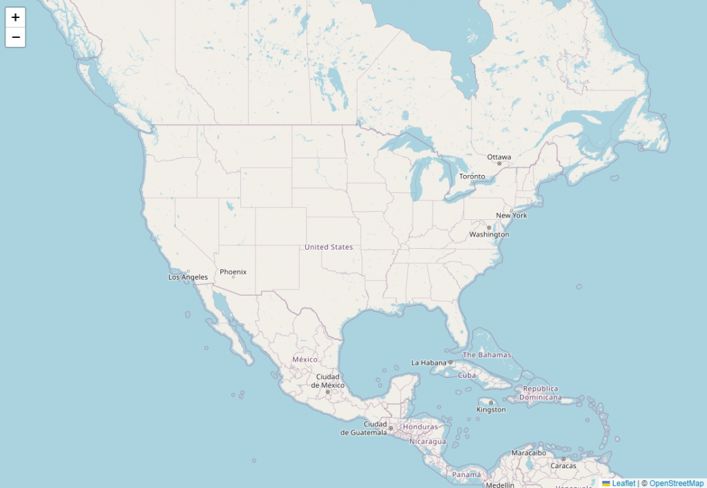
In subsequent tutorials, we will be adding data, layers, controls, styling, and plugins.